
About
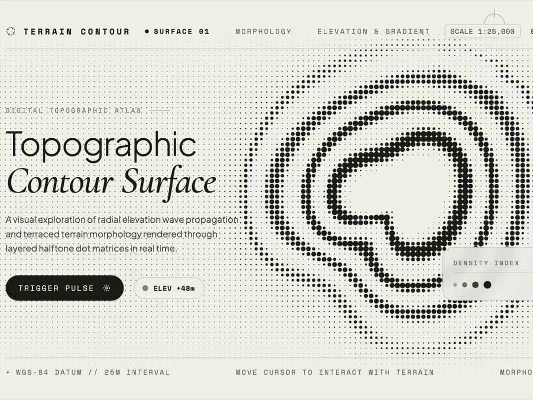
Topographic Contour Surface is an interactive digital topographic atlas that transforms elevation data and terraced terrain morphology into a living, real-time halftone dot matrix.
Built with React and Tailwind. Copy the prompt and paste it into Claude Code, Cursor or Lovable: your agent adds Terrain Contour to your project and fits it to your theme.
Code
How Terrain Contour is used: the demo's code. The component's own source comes with a free account.
Usage.tsx
import React, { useEffect, useRef, useState } from 'react';
/**
* TOPOGRAPHIC CONTOUR SURFACE — EDITORIAL LANDING ENGINE
* A responsive single-file React component featuring a real-time
* halftone topographic contour canvas with outward radial wave propagation,
* vertical edge dot attenuation, and interactive cursor ripple distortion.
*/
export default function App() {
const canvasRef = useRef(null);
const [elevation, setElevation] = useState(240);
// Mutable animation & pointer state stored in refs to avoid React re-renders per frame
const stateRef = useRef({
width: 0,
height: 0,
dpr: 1,
time: 0,
lastTimestamp: 0,
pointerX: -9999,
pointerY: -9999,
smoothPointerX: -9999,
smoothPointerY: -9999,
pointerActive: false,
seismicBoost: 0,
lastReportedElev: 240,
});
// Trigger a temporary seismic wave pulse
const handleTriggerPulse = () => {
stateRef.current.seismicBoost = 1.0;
};
useEffect(() => {
const canvas = canvasRef.current;
if (!canvas) return;
const ctx = canvas.getContext('2d', { alpha: false });
if (!ctx) return;
// Inject editorial fonts dynamically for standalone preview fidelity
const fontLinkId = 'topo-editorial-fonts';
if (!document.getElementById(fontLinkId)) {
const link = document.createElement('link');
link.id = fontLinkId;
link.rel = 'stylesheet';
link.href =
'https://fonts.googleapis.com/css2?family=Cormorant+Garamond:ital,wght@0,500;0,600;1,500&family=Plus+Jakarta+Sans:wght@300;400;500;600&family=Space+Mono:wght@400;700&display=swap';
document.head.appendChild(link);
}
const resizeCanvas = () => {
const state = stateRef.current;
const rect = canvas.parentElement
? canvas.parentElement.getBoundingClientRect()
: { width: window.innerWidth, height: window.innerHeight };
state.dpr = Math.min(window.devicePixelRatio || 1, 2);
state.width = Math.max(1, rect.width || window.innerWidth);
state.height = Math.max(1, rect.height || window.innerHeight);
canvas.width = Math.floor(state.width * state.dpr);
canvas.height = Math.floor(state.height * state.dpr);
ctx.setTransform(state.dpr, 0, 0, state.dpr, 0, 0);
};
const updatePointer = (x, y) => {
const state = stateRef.current;
state.pointerX = x;
state.pointerY = y;
if (!state.pointerActive) {
state.smoothPointerX = x;
state.smoothPointerY = y;
state.pointerActive = true;
}
};
const handleMouseMove = (e) => {
updatePointer(e.clientX, e.clientY);
};
const handleTouchMove = (e) => {
if (e.touches && e.touches.length > 0) {
updatePointer(e.touches[0].clientX, e.touches[0].clientY);
}
};
const handleMouseLeave = () => {
stateRef.current.pointerActive = false;
};
window.addEventListener('resize', resizeCanvas);
window.addEventListener('mousemove', handleMouseMove);
window.addEventListener('touchmove', handleTouchMove, { passive: true });
window.addEventListener('mouseleave', handleMouseLeave);
resizeCanvas();
// Compute responsive center & scale so the contour surface balances with editorial typography
const getContourLayout = (w, h) => {
if (w >= 1024) {
return {
cx: w * 0.65,
cy: h * 0.49,
scale: Math.min(w * 0.34, h * 0.44),
};
} else if (w >= 768) {
return {
cx: w * 0.68,
cy: h * 0.48,
scale: Math.min(w * 0.32, h * 0.40),
};
} else {
return {
cx: w * 0.50,
cy: h * 0.35,
scale: Math.min(w * 0.44, h * 0.28),
};
}
};
/**
* Computes organically distorted radial distance forming terraced terrain indentations
* paired with continuous outward radial wave propagation.
*/
const getOrganicContourRadius = (nx, ny, t, boost) => {
const rx = nx * 1.04;
const ry = ny * 0.96;
const r = Math.hypot(rx, ry);
const theta = Math.atan2(ry, rx);
// Characteristic valley indentation on the bottom-left quadrant (~132 deg / 2.31 rad)
let dTheta = theta - 2.31;
while (dTheta > Math.PI) dTheta -= Math.PI * 2;
while (dTheta < -Math.PI) dTheta += Math.PI * 2;
const indent = 0.165 * Math.exp(-Math.pow(dTheta / 0.44, 2));
const upperLobe = 0.045 * Math.cos(theta * 2.0 + 0.55 + Math.sin(t * 0.8) * 0.12);
const sideWave = 0.025 * Math.sin(theta * 3.0 - 0.4 - t * 0.6);
// Outward radial wave propagating smoothly from center toward outer boundary
const amp = 0.022 + boost * 0.030;
const outwardRipple = amp * Math.sin(r * 14.0 - t * 2.8) * Math.min(1, r * 2.5);
return r + indent - upperLobe - sideWave - outwardRipple;
};
/**
* Evaluates halftone dot density at each grid coordinate (px, py),
* generating 4 layered elevation contour rings separated by clean gaps.
*/
const evaluateUnifiedField = (px, py, cx, cy, scale, t) => {
const state = stateRef.current;
let nx = (px - cx) / scale;
let ny = (py - cy) / scale;
// Cursor interaction: creates concentric ripple waves when approaching the contour
let cursorWaveOffset = 0;
if (state.pointerActive) {
const dxp = px - state.smoothPointerX;
const dyp = py - state.smoothPointerY;
const distP = Math.hypot(dxp, dyp);
const influenceRadius = scale * 0.72;
if (distP < influenceRadius) {
const falloff = Math.pow(1 - distP / influenceRadius, 2);
const ripple = Math.sin(distP * 0.14 - t * 9.5) * falloff;
cursorWaveOffset = ripple * 0.048;
const radialPush = falloff * (0.045 + 0.025 * Math.sin(distP * 0.1 - t * 8.0));
nx -= (dxp / (distP + 1)) * radialPush;
ny -= (dyp / (distP + 1)) * radialPush;
}
}
const d = getOrganicContourRadius(nx, ny, t, state.seismicBoost) + cursorWaveOffset;
// 1. Clean central summit basin without dots
const innerHoleRadius = 0.255 + (0.012 + state.seismicBoost * 0.016) * Math.sin(t * 2.8);
if (d < innerHoleRadius) {
return -1.0;
}
// 2. Four terraced contour elevation rings with clear spacing gaps
const ringSpecs = [
{ center: 0.345, halfWidth: 0.068, peak: 1.00 },
{ center: 0.515, halfWidth: 0.062, peak: 0.84 },
{ center: 0.680, halfWidth: 0.056, peak: 0.66 },
{ center: 0.845, halfWidth: 0.052, peak: 0.48 },
];
let maxRingVal = 0;
const waveAmp = 0.016 + state.seismicBoost * 0.024;
for (let i = 0; i < ringSpecs.length; i++) {
const ring = ringSpecs[i];
const phaseShift = waveAmp * Math.sin(t * 2.8 - i * 1.15);
const dynamicCenter = ring.center + phaseShift;
const dynamicHalfWidth = ring.halfWidth * (1 + 0.08 * Math.sin(t * 2.8 - i * 1.15));
const distFromRing = Math.abs(d - dynamicCenter);
if (distFromRing < dynamicHalfWidth) {
const norm = distFromRing / dynamicHalfWidth;
const profile = Math.pow(Math.cos(norm * Math.PI * 0.5), 1.35);
const pulsePeak = ring.peak * (0.92 + 0.08 * Math.sin(t * 2.8 - i * 1.15));
maxRingVal = Math.max(maxRingVal, pulsePeak * profile);
}
}
// 3. Subtle outer lowland halo
if (d >= 0.88 && d < 1.24) {
const outerWave = 0.5 + 0.5 * Math.sin(d * 18.0 - t * 2.8);
const haloFade = (0.08 + 0.08 * outerWave) * Math.exp(-Math.pow((d - 0.88) / 0.16, 2));
maxRingVal = Math.max(maxRingVal, haloFade);
}
return Math.max(0, Math.min(1, maxRingVal));
};
const render = () => {
const state = stateRef.current;
const { width: w, height: h, time: t } = state;
if (w <= 0 || h <= 0) return;
ctx.fillStyle = '#F3F1EC';
ctx.fillRect(0, 0, w, h);
const { cx, cy, scale } = getContourLayout(w, h);
const spacing = Math.max(5.5, scale / 34);
const minRadius = Math.max(0.55, spacing * 0.075);
const maxRadius = spacing * 0.69;
// Vertical fade zones (top & bottom) to keep header and footer clean
const topFadeEnd = h * 0.24;
const bottomFadeStart = h * 0.76;
ctx.fillStyle = '#191E12';
ctx.beginPath();
const startCol = Math.floor(-cx / spacing) - 1;
const endCol = Math.ceil((w - cx) / spacing) + 1;
const startRow = Math.floor(-cy / spacing) - 1;
const endRow = Math.ceil((h - cy) / spacing) + 1;
for (let r = startRow; r <= endRow; r++) {
const py = cy + r * spacing;
// Smoothstep vertical attenuation at top and bottom margins
let verticalFade = 1.0;
if (py < topFadeEnd) {
const normY = Math.max(0, Math.min(1, py / topFadeEnd));
verticalFade = normY * normY * (3 - 2 * normY);
} else if (py > bottomFadeStart) {
const normY = Math.max(0, Math.min(1, (h - py) / (h - bottomFadeStart)));
verticalFade = normY * normY * (3 - 2 * normY);
}
if (verticalFade <= 0.01) continue;
for (let c = startCol; c <= endCol; c++) {
const px = cx + c * spacing;
const val = evaluateUnifiedField(px, py, cx, cy, scale, t);
if (val < 0) continue;
const baseRadius = minRadius + Math.pow(val, 1.12) * (maxRadius - minRadius);
const radius = baseRadius * verticalFade;
if (radius > 0.15) {
ctx.moveTo(px + radius, py);
ctx.arc(px, py, radius, 0, Math.PI * 2);
}
}
}
ctx.fill();
// Subtle cartographic reticle around active cursor
if (state.pointerActive) {
ctx.save();
ctx.strokeStyle = 'rgba(25, 30, 18, 0.28)';
ctx.lineWidth = 1;
ctx.beginPath();
ctx.arc(state.smoothPointerX, state.smoothPointerY, 16, 0, Math.PI * 2);
ctx.moveTo(state.smoothPointerX - 24, state.smoothPointerY);
ctx.lineTo(state.smoothPointerX - 10, state.smoothPointerY);
ctx.moveTo(state.smoothPointerX + 10, state.smoothPointerY);
ctx.lineTo(state.smoothPointerX + 24, state.smoothPointerY);
ctx.moveTo(state.smoothPointerX, state.smoothPointerY - 24);
ctx.lineTo(state.smoothPointerX, state.smoothPointerY - 10);
ctx.moveTo(state.smoothPointerX, state.smoothPointerY + 10);
ctx.lineTo(state.smoothPointerX, state.smoothPointerY + 24);
ctx.stroke();
ctx.restore();
}
};
let animationFrameId = 0;
const animate = (timestamp) => {
const state = stateRef.current;
if (!state.lastTimestamp) state.lastTimestamp = timestamp;
const dt = Math.min((timestamp - state.lastTimestamp) / 1000, 0.05);
state.lastTimestamp = timestamp;
state.time += dt;
if (state.seismicBoost > 0.001) {
state.seismicBoost *= Math.pow(0.25, dt);
} else {
state.seismicBoost = 0;
}
if (state.pointerActive) {
state.smoothPointerX += (state.pointerX - state.smoothPointerX) * Math.min(1, dt * 8);
state.smoothPointerY += (state.pointerY - state.smoothPointerY) * Math.min(1, dt * 8);
const { cx, cy, scale } = getContourLayout(state.width, state.height);
const distNorm = Math.hypot(state.smoothPointerX - cx, state.smoothPointerY - cy) / scale;
const nextElev = Math.max(15, Math.round(400 - Math.min(1.2, distNorm) * 320));
if (nextElev !== state.lastReportedElev) {
state.lastReportedElev = nextElev;
setElevation(nextElev);
}
}
render();
animationFrameId = requestAnimationFrame(animate);
};
animationFrameId = requestAnimationFrame(animate);
return () => {
cancelAnimationFrame(animationFrameId);
window.removeEventListener('resize', resizeCanvas);
window.removeEventListener('mousemove', handleMouseMove);
window.removeEventListener('touchmove', handleTouchMove);
window.removeEventListener('mouseleave', handleMouseLeave);
};
}, []);
return (
<div
className="relative w-full h-screen overflow-hidden bg-[#F3F1EC] text-[#191E12] select-none"
style={{ fontFamily: "'Plus Jakarta Sans', sans-serif" }}
>
<style>{`
.font-serif-editorial {
font-family: 'Cormorant Garamond', Georgia, serif;
}
.font-mono-tech {
font-family: 'Space Mono', monospace;
}
.topo-hairline {
border-color: rgba(25, 30, 18, 0.14);
}
@keyframes slowSpin {
from { transform: rotate(0deg); }
to { transform: rotate(360deg); }
}
.animate-reticle {
animation: slowSpin 24s linear infinite;
}
`}</style>
{/* Primary Canvas: Topographic Contour Surface */}
<div className="absolute inset-0 z-0">
<canvas ref={canvasRef} className="block w-full h-full" />
</div>
{/* Architectural Cartographic Frame & Editorial Layout */}
<div className="relative z-10 flex flex-col justify-between w-full h-full p-4 sm:p-7 md:p-10 pointer-events-none">
{/* 1. Minimalist Header Row with Precision Hairline */}
<header className="flex items-center justify-between w-full pb-3.5 sm:pb-4 border-b topo-hairline">
<div className="flex items-center gap-3 pointer-events-auto">
{/* Micro Cartographic Compass Icon */}
<svg
className="w-4 h-4 text-[#191E12] animate-reticle"
viewBox="0 0 24 24"
fill="none"
stroke="currentColor"
strokeWidth="1.5"
>
<circle cx="12" cy="12" r="9" strokeDasharray="2 2" />
<path d="M12 2v4M12 18v4M2 12h4M18 12h4" />
</svg>
<span className="font-mono-tech text-xs sm:text-[13px] tracking-[0.26em] uppercase font-bold">
TERRAIN CONTOUR
</span>
</div>
{/* Center Navigation with Active Indicator */}
<nav className="hidden lg:flex items-center gap-10 font-mono-tech text-[11px] tracking-[0.2em] uppercase text-[#191E12]/65 pointer-events-auto">
<a href="#surface" className="text-[#191E12] font-bold flex items-center gap-2">
<span className="w-1.5 h-1.5 rounded-full bg-[#191E12]" />
Surface 01
</a>
<a href="#morphology" className="hover:text-[#191E12] transition-colors">
Morphology
</a>
<a href="#elevation" className="hover:text-[#191E12] transition-colors">
Elevation & Gradient
</a>
</nav>
{/* Top-Right Survey Coordinates */}
<div className="flex items-center gap-4 font-mono-tech text-[10px] sm:text-[11px] tracking-wider text-[#191E12]/75">
<span className="hidden sm:inline-block px-2 py-0.5 rounded border topo-hairline bg-[#F3F1EC]/70 backdrop-blur-sm">
SCALE 1:25,000
</span>
<span className="font-bold">06°14'S 106°59'E</span>
</div>
</header>
{/* 2. Main Area: Asymmetric Editorial Composition */}
<main className="grid grid-cols-1 md:grid-cols-12 items-center md:items-end w-full my-auto md:my-0 gap-6">
{/* Left Column: Editorial Typography & Controls */}
<div className="md:col-span-6 lg:col-span-5 flex flex-col justify-between bg-[#F3F1EC]/75 md:bg-transparent backdrop-blur-md md:backdrop-blur-none border md:border-0 topo-hairline rounded-2xl p-5 sm:p-6 md:p-0 pointer-events-auto">
{/* Metadata Tag */}
<div className="flex items-center gap-3 mb-3 sm:mb-4">
<span className="font-mono-tech text-[10px] uppercase tracking-[0.25em] text-[#191E12]/60">
DIGITAL TOPOGRAPHIC ATLAS
</span>
<span className="h-[1px] w-8 bg-[#191E12]/25" />
</div>
{/* High-Contrast Display Headline */}
<h1 className="text-3xl sm:text-4xl lg:text-[52px] font-light tracking-tight leading-[1.06] text-[#191E12]">
Topographic
<span className="block font-serif-editorial italic font-medium text-4xl sm:text-5xl lg:text-[60px] text-[#191E12] mt-0.5">
Contour Surface
</span>
</h1>
{/* Concise Editorial Description */}
<p className="mt-4 sm:mt-5 text-xs sm:text-sm leading-relaxed text-[#191E12]/75 max-w-sm font-normal">
A visual exploration of radial elevation wave propagation and terraced terrain morphology rendered through layered halftone dot matrices in real time.
</p>
{/* Action Row & Live Elevation Telemetry */}
<div className="mt-6 sm:mt-8 flex flex-wrap items-center gap-4">
<button
type="button"
onClick={handleTriggerPulse}
className="group relative inline-flex items-center gap-3 px-5 py-3 rounded-full bg-[#191E12] text-[#F3F1EC] hover:bg-[#2A321E] active:scale-[0.98] transition-all text-xs font-mono-tech tracking-[0.16em] uppercase cursor-pointer shadow-sm"
>
<span>Trigger Pulse</span>
<svg
className="w-3.5 h-3.5 transition-transform duration-300 group-hover:translate-x-0.5"
viewBox="0 0 24 24"
fill="none"
stroke="currentColor"
strokeWidth="2"
>
<circle cx="12" cy="12" r="3" />
<circle cx="12" cy="12" r="8" strokeDasharray="3 3" />
</svg>
</button>
{/* Live Cursor Telemetry Readout */}
<div className="flex items-center gap-2.5 px-3.5 py-2 rounded-full border topo-hairline bg-[#F3F1EC]/80 backdrop-blur-sm">
<span className="w-1.5 h-1.5 rounded-full bg-[#191E12] animate-ping" />
<span className="font-mono-tech text-[11px] tracking-wider text-[#191E12] font-bold">
ELEV +{elevation}m
</span>
</div>
</div>
</div>
{/* Right Column: Open Breathing Space for the Contour Surface */}
<div className="hidden md:flex md:col-span-6 lg:col-span-7 flex-col items-end justify-end h-full">
{/* Minimalist Cartographic Density Legend Card */}
<div className="bg-[#F3F1EC]/80 backdrop-blur-md border topo-hairline rounded-2xl p-4 w-64 pointer-events-auto">
<div className="flex items-center justify-between mb-2.5 pb-2 border-b topo-hairline">
<span className="font-mono-tech text-[10px] uppercase tracking-[0.2em] text-[#191E12]/65">
DENSITY INDEX
</span>
<span className="font-mono-tech text-[10px] font-bold">4 LAYERS</span>
</div>
<div className="flex items-center justify-between gap-2">
<div className="flex items-center gap-2">
<span className="w-1.5 h-1.5 rounded-full bg-[#191E12]/30" />
<span className="w-2 h-2 rounded-full bg-[#191E12]/55" />
<span className="w-2.5 h-2.5 rounded-full bg-[#191E12]/80" />
<span className="w-3 h-3 rounded-full bg-[#191E12]" />
</div>
<span className="font-mono-tech text-[11px] text-[#191E12]/80">0m — 400m</span>
</div>
</div>
</div>
</main>
{/* 3. Precision Footer with Corner Markers */}
<footer className="flex items-center justify-between w-full pt-3.5 border-t topo-hairline font-mono-tech text-[10px] sm:text-[11px] tracking-[0.18em] uppercase text-[#191E12]/65">
<div className="flex items-center gap-2">
<span>+</span>
<span>WGS-84 DATUM // 25M INTERVAL</span>
</div>
<div className="hidden sm:block">MOVE CURSOR TO INTERACT WITH TERRAIN</div>
<div className="flex items-center gap-2">
<span>MORPHOLOGY STUDIO</span>
<span>+</span>
</div>
</footer>
</div>
</div>
);
}More by pstzx
View all
Button Payment
109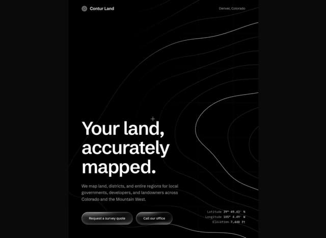
Contour Land Map
29
Sign In Water Effect Glass
26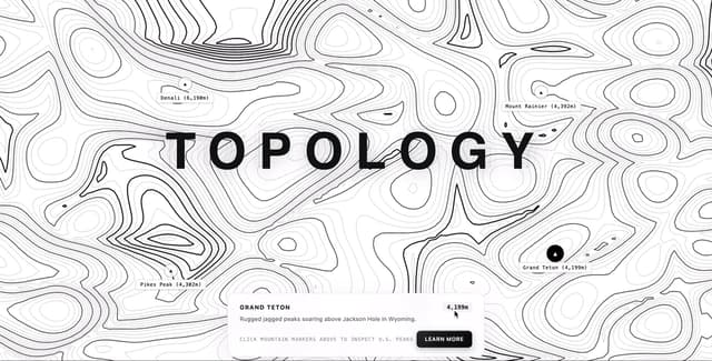
Contour line Mountain
22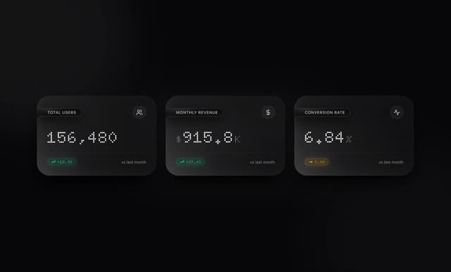
Card Dashboard Analytic
12
Loading Screen Glass
12
21 st Contour Line
12
Contour line map
11
More in Shaders
View all
Glass Fold
493

Shader Animation
3.9K
Wave
717

Illos Knowledge Sources
54

Phosphor 30
314
animated pattern cloud
634
Stripe like gradient-shader
272
Shader Background
2K


